Depth sensing
Stereo 3D
Actual geometry — not 2D guesses

Depth cameras on the seeder map every rock as you seed. No extra pass. Then FarmIQ™ takes over — navigate your crew directly to each rock, mark it picked, watch it disappear from the list. Scan to done. All in one loop.
● 3D STEREO DEPTH · actual geometry, not 2D guessesDepth-sensing cameras on the seeder bar measure the ground as you seed. Objects that rise above the soil — rocks, debris — get logged with size, position, and coordinates. Everything feeds into FarmIQ™.
A flat image can't tell a rock from a shadow, a dark patch of soil, or a clump of residue. Stereo depth measures actual 3D shape — anything tall enough to matter shows up, anything flat doesn't. Fewer false positives, fewer missed rocks.
It also runs in conditions where regular cameras struggle: low light, harsh shadows, heavy crop residue. If it's sticking up, it gets logged.
After a field scan, open FarmIQ™ on any phone or tablet. Every detected rock appears as a pin on a live map. Tap one — the app routes you straight there. Pick it. Hit Picked. It's gone from the list for everyone on the crew.
Interactive demo — three fields, 4,300+ rocks. Filter by size, tap rocks, mark them picked. No signup.
Every rock is a pin on a live map. Tap any pin and it routes you straight there — no hunting, no doubling back, no missed corners.
One button removes a rock from the map for the whole crew. No paper list, no radio calls, no re-driving. The record stays — you can see what was picked, by whom, and when.
Every device sees the same live map updating in real time. Nobody works a rock that's already done.
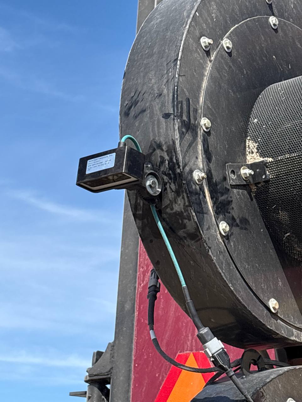
The depth-camera unit packs stereo vision, georeferencing, and onboard AI processing in a single mountable enclosure. Bolts to the seeder or air-drill bar, any size. Power over Ethernet — one cable to the cab, no specialized brackets.
Active field deployment in 2026. We're dialing in size-threshold tuning and Rock Picker workflows alongside the first customers running it. Early customers get hands-on tuning support directly from the engineering team.
Rocky operation? We want to hear from you.
Rock maps persist in FarmIQ™ between seasons. Compare what came back after tillage, what you've cleared, what's still sitting. Your field knowledge compounds — not just for rock picking, but for routing seeders and planters around permanent obstacles.
The depth-camera unit bolts to the seeder bar. No specialized mounting required. One PoE cable to the cab.
Every rock gets a coordinate, a size estimate, and a timestamp — synced to FarmIQ™. Rocks you flag as immovable stay on the map permanently as obstacles.
Compare what came back after tillage, what you've cleared, what's still there. The map is yours every year — data you built, not data you re-collect.
Tell us what you're running and what your fields look like. We'll set up a demo on real equipment and give you a straight answer — direct from the team that builds it.
Get in touch